Unlike traditional county systems, property records in the Naugatuck Valley Planning Region, Connecticut, are not administered by a single governing office. Instead, responsibility rests with each of the 19 municipalities that make up the region. Local offices manage deeds, mortgages, liens, and assessment records within their respective jurisdictions.
How to Search for Property Records in the Naugatuck Valley Planning Region

Residents and researchers have multiple options when searching for property records in the Naugatuck Valley Planning Region, CT. Most municipalities maintain online search systems on their official websites. These platforms typically allow users to review parcel descriptions, ownership details, assessed values, and recorded transfers.
If a record is not available online, requests may be made directly with the appropriate municipal office. In-person visits to the town clerk or assessor’s office allow access to official volumes, maps, and archived documents. Requests may also be submitted by mail or email, but these inquiries should clearly identify the property and specify the requested documents.
Among the information that can help offices or online databases locate a specific document are the full property address, the owner’s name, and the parcel number. Some recorded instruments may also be indexed by grantor/grantee name, recording date, document type, and legal description.
Note that when searching Naugatuck Valley Planning Region property records, access limitations may apply. Older documents may not be digitized, and access policies, copy fees, and system features vary by municipality.
To simplify the process, researchers can consult PropertyChecker for aggregated property data. The service compiles public records from various municipalities across the region. By presenting ownership summaries and valuation information together, it can limit the need for separate searches through individual municipal databases.
 Property Ownership and Title Information
Ownership and title records in the Naugatuck Valley Planning Region are accessed through the clerk’s office of the town or city where the property is located. Several municipalities offer web-based land record databases that include indexed listings and, when available, scanned copies of recorded instruments.
As an example, the Waterbury Town Clerk hosts an online Land Records Index that supports searches by grantor or grantee name, document type, recording date, and book or page number. This tool can reveal documents such as deeds, assignments, and lien filings that can disclose ownership history and any recorded claims against the property.
If online systems are unavailable or provide only limited documents, individuals may visit the clerk’s office to examine records. Written requests for copies may also be accepted by mail or email, depending on municipal policy.
 Property Sales and Transaction History
Municipal clerks in the Naugatuck Valley Planning Region can provide access to property sales records. These offices preserve recorded deeds, conveyance tax returns, and related filings that can identify transfer dates, buyer and seller names, and declared consideration. Records may be reviewed in person at the clerk’s office or through online land record systems when available.
Local assessor offices may also display transaction details through searchable databases. For example, the City of Ansonia Assessor offers an online Property Record Cards tool that allows searches by owner name, address, or parcel number to view sale dates and deed references.
If a municipality does not maintain an online database, individuals may use PropertyChecker to review compiled public sales data. Searches can typically be conducted by address, ZIP code, owner name, or parcel identification number to obtain transaction timelines.
 Property Tax Assessment and Payment Records
In the Naugatuck Valley Planning Region, municipal property tax assessors are responsible for maintaining assessment records, valuation history, and approved exemptions. Property owners may review this information through online assessor databases, such as the Property Record Cards system provided by the City of Ansonia Assessor, or by visiting the office directly.
If an owner believes an assessment is inaccurate, a formal appeal may be filed with the assessor’s office or local board of assessment appeals.
Municipal tax collector offices oversee tax bills, payment records, and delinquent balances. Many offices provide online search and payment systems for viewing and paying real estate taxes, such as the Tax Bills Search and Pay offered by the Town of Beacon Falls Tax Collector. Offices also respond to inquiries in person or, if applicable, by phone or through written request.
 Property Characteristics and Parcel Details
To obtain property characteristics and parcel details in the Naugatuck Valley Planning Region, refer to the online lookup tools maintained by local assessor offices. These tools can facilitate a property parcel search that can provide information on lot dimensions, building data, and structural descriptions. Usually, these tools accept parcel ID, owner name, and street address.
If a specific assessor’s office does not offer an online portal, individuals can visit their office location in person or utilize the statewide Connecticut Parcel Viewer tool.
 Zoning, Land Use, and Planning Records
Each municipality’s planning and zoning department provides access to zoning, land use, and development records within the Naugatuck Valley Planning Region. These records may include land use ordinances, approved site plans, and variance applications.
Interested parties can access these records in person at the department office. They may also request subdivision records, special permit decisions, and zoning compliance letters by mail or email, with submission procedures and applicable fees determined by the municipality.
Some municipalities publish zoning resources online. For instance, the Town of Oxford Planning and Zoning Department provides a zoning map along with other planning and zoning resources on its official website.
 Legal Documents Affecting Property
Municipal clerks in the Naugatuck Valley Planning Region maintain legal documents that affect property ownership and interests. Records are typically accessible via online land record portals or directly at the clerk’s office, where record-seekers can search by parcel number, owner name, or document type.
Typical filings include recorded deeds, mortgages, liens, easements, releases, and lis pendens notices. Mortgages can secure loans, while liens represent unpaid debts. Easements may provide limited use rights, and deeds can document ownership transfer. Court notices or judgments may also restrict transfers until they are resolved.
 Building Permits, Inspections, and Construction Records
Municipal building and inspection departments maintain building permits, inspection reports, and construction records in the Naugatuck Valley Planning Region. These offices oversee permit issuance, code compliance, plan review, and required inspections within their jurisdictions. Records may be reviewed in person at the local building department during office hours.
Online access is also available in some municipalities. In Waterbury, the Department of Inspections provides permit data through its official website. City residents can also utilize the Waterbury GIS portal, which can display permit type and issuance date. In Bristol, the Building Department maintains a search for public records for viewing permit and inspection details.
 Maps and Visual Property Data
The mapping and visual property data for nearly 158,000 parcels across the Naugatuck Valley Planning Region are accessible from municipal assessor online databases, like the Property Record Cards offered by the City of Ansonia Assessor. Municipal GIS applications, such as the Waterbury GIS in the City of Waterbury, can also provide map and visual data.
Individuals can usually enter the parcel number, property address, or owner name on these resources. Among the information they can obtain are parcel boundary lines, land area, and lot dimensions. Some tools may also include basemap layers, aerial imagery, and overlays to help individuals visualize property features and surrounding infrastructure.
Naugatuck Valley Planning Region Registrar of Deeds
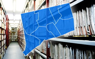
There is no centralized county registrar in the Naugatuck Valley Planning Region. Instead, the town or city clerk in each municipality performs the registrar of deeds function. These offices maintain recorded deeds, mortgage documents, lien filings, easements, boundary agreements, and other title instruments for properties located within their limits.
The information contained in these records can affect property tax assessments, zoning compliance reviews, and land development approvals. Municipal assessors and planning officials consult recorded documents to confirm ownership transfers, legal descriptions, and any restrictions tied to the land.
Access methods vary by municipality. Records are commonly available through online land record search systems, in-person review, or written requests by mail or email. Recording fees and copy charges follow Connecticut statutory requirements and local fee schedules.
Municipality-Level Property Records Information
Property records in the Naugatuck Valley Planning Region are maintained by the 19 member municipalities that make up the region. Each town or city is responsible for preserving its own recorded deeds, mortgage filings, liens, assessment data, and zoning information.
Individuals can review these materials in person at the appropriate municipal department or through online record search tools available on official government websites.
County Offices That Maintain Naugatuck Valley Planning Region Property Records
There is no countywide or regional recorder serving the Naugatuck Valley Planning Region. Instead, all 19 member towns and cities manage their own property records, including deeds, liens, mortgage filings, tax assessments, and land use documents.
Although the Naugatuck Valley Council of Governments operates within the region, it does not maintain property filings. Its responsibilities center on planning and policy collaboration. Individuals seeking documents must contact the local municipal offices, such as the town or city clerk, assessor, or planning department, which serve as the lawful custodians of these records.
Other Counties in Connecticut
- Fairfield County
- Greater Bridgeport Planning Region
- Hartford County
- Litchfield County
- Lower Connecticut River Valley Planning Region
- New Haven County
- New London County
- Northeastern Connecticut Planning Region
- Northwest Hills Planning Region
- South Central Connecticut Planning Region
- Southeastern Connecticut Planning Region
- Western Connecticut Planning Region