Property research in the Western Connecticut Planning Region requires understanding Connecticut’s unique municipal record system. Without county recorders, the region’s three cities and 15 towns maintain property and land records independently. These documents serve essential purposes, such as monitoring assessments and verifying ownership.
How to Search for Property Records in Western Connecticut Planning Region

Property records in the Western Connecticut Planning Region are available through several access points. Most cities and towns offer online land records and assessment databases, commonly accessed through regional resources like WestCOG. In addition to municipal online databases, records may be requested in person at city/town halls or submitted by mail or email.
Before starting, users should gather key details to help narrow results. A full property address works best, while a parcel or map number, owner name, or subdivision name can further improve accuracy.
PropertyChecker streamlines this process by consolidating municipal records into a searchable platform. Where available, it reduces processing delays by offering faster digital access.
However, access has limits. Some older records are not digitized, certified copies usually require fees, and certain personal details may be restricted. Processing times also vary by city or town.
 Property Ownership and Title Information
Property ownership and title records in the Western Connecticut Planning Region are accessed at the municipal level. Each city or town clerk acts as the register or recorder of deeds and provides in-person access at town halls and online access through local land records portals. Many municipalities publish records through their own online databases, where available.
Records usually contain the owner’s name, property address, parcel or map number, recording date, and document references.
To prove ownership, users typically rely on recorded property records that show the current owner of record. These include land records documenting transfers, recorded instruments tied to the parcel, and official entries indexed under the owner’s name. Reviewing the most recent recorded transaction is essential to confirm present ownership.
 Property Sales and Transaction History
Property sales and transaction history in the Western Connecticut Planning Region can be retrieved through municipal land records and assessor-linked databases maintained by each town or city. These records are available online, where digitized, or in person through the local clerk’s or assessor’s office, depending on the municipality.
To search property sales, users can start with assessor tools that track transfers tied to a parcel. Platforms such as the MapGeo Property Search allow searches by address, owner, or map number and often display recent sale prices. PropertyChecker also aggregates sales and transaction history across cities and towns for broader comparisons.
Records typically list sale date, consideration amount, grantor and grantee names, and document references. Local property appraisers use this data to support valuation and ratio studies, which make city or town-level searches essential since there is no county recorder in Connecticut.
 Property Tax Assessment and Payment Records
In the Western Connecticut Planning Region, municipal property tax assessors determine assessed values in accordance with state law. Property owners can review assessed values through local assessor portals or the MapGeo Property Search.
Tax bills, payment history, and delinquency information are administered separately by each municipality’s tax office. Once new assessments are released, property owners may review changes that affect their tax bills. If necessary, they can file an appeal with the local Board of Assessment Appeals within the city or town’s prescribed timeframe.
 Property Characteristics and Parcel Details
Property characteristics and parcel details in the Western Connecticut Planning Region can be accessed through municipal assessor databases or regional GIS tools, which provide mapped parcel information and related property records. Each parcel is assigned a unique identifier and maintained locally by the town or city assessor.
Parcel data from individual municipalities is compiled through regional Councils of Governments and standardized by the Connecticut Office of Policy and Management (OPM).
Through the OPM GIS Office, users can access online parcel viewers to explore mapped data and download parcel information, including CAMA (Computer-Assisted Mass Appraisal) records that support property assessments and valuations.
 Zoning, Land Use, and Planning Records
Individuals can retrieve zoning, land use, and planning records in the Western Connecticut Planning Region through city or town zoning offices and local planning departments. These offices provide zoning regulations, approved land uses, comprehensive plans, and development applications, either online or at municipal offices.
Many cities and towns also publish interactive zoning maps that show zoning districts, overlays, and permitted uses by parcel. Alternatively, users can search the WestCOG Data Hub for downloadable datasets.
 Legal Documents Affecting Property
Legal documents affecting property in the Western Connecticut Planning Region are recorded at the municipal level. These records are accessible online through the city or town’s online search portal, where applicable, or in person at the appropriate municipal clerk’s office.
Common documents include deeds, mortgages, mortgage releases, liens, easements, covenants, foreclosure filings, and notices affecting title. Users can search by grantor or grantee name, document type, recording date, or volume and page reference, depending on the local system.
 Building Permits, Inspections, and Construction Records
Building permits, inspection reports, and construction records in the Western Connecticut Planning Region are handled by city or town building departments. Access is provided through municipal permit portals or directly at local building and inspection offices, depending on the city or town’s system and record format.
Many municipalities provide online access to permits and inspection records, including details such as issued permits, project descriptions, contractor information, and approval dates. Records typically cover permit numbers, scope of work, inspection outcomes, certificates of occupancy, and final approvals.
 Maps and Visual Property Data
Maps and visual property data for more than 205,000 parcels in Western Connecticut are available through municipal GIS portals, assessor map systems, and statewide mapping resources.
Town-level map viewers often show parcel boundaries, lot dimensions, street layouts, and zoning layers, while regional context is available through the Connecticut Office of Policy and Management (OPM) planning region maps.
Western Connecticut Planning Region Registrar of Deeds
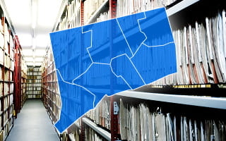
In the Western Connecticut Planning Region, each city or town clerk serves as the registrar of deeds. Each city or town clerk’s office records and preserves deeds, mortgages, liens, easements, releases, and related filings. The accumulated records span decades and provide a documented chain of title for each property.
These land records directly affect other property data. Assessors rely on recorded documents to confirm legal ownership, track transfers, and identify parcel splits or mergers. These records, in turn, influence assessments, zoning reviews, and land use decisions across municipal offices.
Records are available online through the town land records system, when available, and in person at the appropriate town or city clerk’s office. Requests may also be submitted by mail or email, depending on the municipality. Fees vary by town but commonly include per-page copy charges, with certified copies priced higher under local fee schedules.
Municipality-Level Property Records Information
Property research in the Western Connecticut Planning Region relies on knowing how and where to access municipal assessments, zoning data, mapping resources, and official land records. The region includes three cities and 15 towns, each maintaining its own assessor and clerk offices, online portals, and GIS tools to provide public access to property information.
In Stamford, users can review property valuations, parcel details, field cards, and revaluation updates through the city’s online assessment database. Meanwhile, the Town Clerk provides digital access to deeds, mortgages, liens, and historical filings.
Norwalk offers similar online access, including property assessments, exemptions, Grand List summaries, and a Town Clerk search system for land records, supplemented by GIS mapping for zoning and parcel boundaries.
Danbury’s digital assessment database includes parcel cards, current assessed values, structural details, and exemption information. Recorded property documents are accessible through the Town Clerk’s online search system, while its mapping GIS tool provides zoning and parcel information.
Greenwich, New Milford, and other municipalities in the region offer similar resources, including online assessor databases, town clerk land record searches, and GIS tools for zoning and other property-specific information. These tools ensure residents and researchers can efficiently obtain the property information they need.
County Offices That Maintain Western Connecticut Planning Region Property Records
The Western Connecticut Planning Region does not have county-level offices that maintain property records. Instead, all official property documents, including deeds, ownership histories, and tax assessments, are managed individually by each municipality.
While the Western Connecticut Council of Governments (WestCOG) supports regional planning, data coordination, and shared services, it does not maintain, certify, or store legal property records; these records remain with individual municipalities.
Residents, researchers, and investors must consult the appropriate city or town clerk or assessor’s office to access official property information.
Other Counties in Connecticut
- Fairfield County
- Greater Bridgeport Planning Region
- Hartford County
- Litchfield County
- Lower Connecticut River Valley Planning Region
- Naugatuck Valley Planning Region
- New Haven County
- New London County
- Northeastern Connecticut Planning Region
- Northwest Hills Planning Region
- South Central Connecticut Planning Region
- Southeastern Connecticut Planning Region