Property records across the Lower Connecticut River Valley Planning Region are decentralized rather than unified, county-based. Each of the region's municipalities maintains control over its own documentation, which includes deeds, mortgage filings, liens, and property assessments handled at the local level.
How to Search for Property Records in the Lower Connecticut River Valley Planning Region

Property records in the Lower Connecticut River Valley Planning Region are managed at the municipal level. There is no single office that handles all records. Hence, individuals typically need to identify the correct town before searching.
Many towns maintain searchable systems that serve as a convenient starting point for most researchers. These tools can provide parcel information, ownership history, property values, and recorded land documents.
PropertyChecker also consolidates property information from multiple jurisdictions into a single platform. It can help streamline searches by presenting sales data, title history, permit information, and other key property data points, potentially reducing the need for repeated searches across separate town websites.
If online systems do not contain the needed records, other options are available. Individuals may visit town offices to review physical documents. Requests can also be sent by mail or email, provided that enough document information is included.
To conduct an effective search, certain details should be prepared in advance. A full property address is essential in most cases, while parcel identification numbers and owner names help narrow results. Some databases also support searches by recording date or document type.
Individuals should be aware of possible restrictions when accessing the region's property data. Not all municipalities maintain online systems, and some records may not be available digitally. Offices may charge fees for copies or certified documents, and access policies can vary by municipality.
 Property Ownership and Title Information
In the Lower Connecticut River Valley Planning Region, ownership and title records are obtained through local town clerk offices.
Many towns maintain land record systems that allow users to search for warranty and quitclaim deeds, and other title documents by name, address, or recording date. For example, the Clinton Town Clerk offers a Town Clerk Portal for remote access to documents dating back to 1976.
When records are not fully available online, in-person visits allow access to bound volumes and archived indexes. Mail or email requests may also be accepted when sufficient identifying details are included.
 Property Sales and Transaction History
Each municipality within the Lower Connecticut River Valley Planning Region provides access to property sales and transaction history through its local assessor or town clerk's office. Many local systems allow users to view recorded transfers, sale dates, documented prices, and buyer or seller information tied to official conveyance records.
When a municipality does not offer a complete online system, users may turn to PropertyChecker to quickly locate publicly available transaction histories across multiple properties. It allows searches by address, ZIP code, owner name, or parcel number to identify past sales and ownership changes.
 Property Tax Assessment and Payment Records
Property owners in the Lower Connecticut River Valley Planning Region can view assessment details through their municipal assessor or their online databases. For example, the Durham Assessor's Office can be contacted or utilize its Property Record Cards database to view assessed value and exemption data.
Tax bills and payment histories are managed by the town tax collector or revenue office. Many municipalities provide digital portals that allow users to check payment status, review past transactions, and identify any outstanding balances. An example includes the Tax Bill Online system offered by the Portland Collector of Revenue.
Individuals who disagree with their assessment may file an appeal through their local Board of Assessment Appeals. This process typically requires documentation supporting valuation concerns and must be submitted within the municipality’s deadline.
 Property Characteristics and Parcel Details
Municipal assessors in the Lower Connecticut River Valley Planning Region can be consulted to review property characteristics and parcel details. These offices typically provide online databases for property parcel searches, which can reveal lot size, land area, property class, building type, year built, living area, and structural improvements.
When online access is not available, interested parties can obtain property record cards directly from their local assessor's office.
 Zoning, Land Use, and Planning Records
Municipal planning and zoning departments in the Lower Connecticut River Valley Planning Region serve as the official custodians of planning, land use, and zoning records. These records can vary from zoning districts, permitted uses, and site plan approvals to subdivision records, setback requirements, and special permit decisions.
Most municipal zoning offices can provide information through in-person visits or public record requests. Some also publish online resources on their websites, such as the zoning map and GIS mapping offered by the Essex Planning and Zoning/Land Use Department.
 Legal Documents Affecting Property
Clerk offices across the Lower Connecticut River Valley Planning Region maintain and provide access to legal documents affecting property ownership and use. These records commonly include deeds, mortgages, liens, easements, restrictive covenants, and court-related filings that establish or modify property rights.
Many town clerk offices in the region offer online land record systems for public use, allowing searches by name, document number, or recording date. An example is the Land Record Search provided by the Middlefield Town Clerk. Older or archived documents may require formal written requests or in-person review at the clerk’s office.
 Building Permits, Inspections, and Construction Records
Building permit and inspection records in the Lower Connecticut River Valley Planning Region are managed by local building departments. These records typically cover permit applications, inspection results, contractor details, certificates of occupancy, and approved construction plans linked to specific properties.
The Deep River Building Department manages these records within town limits. Similarly, the Killingworth Building Department oversees building permits, inspections, and construction files within its jurisdiction. Access is usually provided through municipal office requests or, if available, online portals.
PropertyChecker also offers a building permit search feature, which allows users to locate permit histories, inspection reports, and construction-related filings tied to specific properties.
 Maps and Visual Property Data
Mapping and visual property data covering nearly 83,000 parcels in the Lower Connecticut River Valley Planning Region are available through municipal GIS portals and assessor databases.
Tools such as the MapGeo provided by the Westbrook Assessor’s Office can provide parcel-level mapping and spatial property details within town limits. Meanwhile, the GIS mapping provided by the Essex Planning and Zoning/Land Use Department can support interactive parcel viewing and detailed land-use visualization for properties within its jurisdiction.
These platforms usually allow individuals to input a parcel ID, property address, or owner name to view land boundaries, lot size, and dimensions. Many systems also include aerial imagery, zoning overlays, and infrastructure layers that help display property layout and surrounding land use.
Lower Connecticut River Valley Planning Region Registrar of Deeds
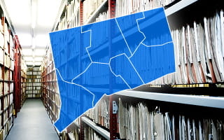
Town clerk offices across the Lower Connecticut River Valley Planning Region serve as the registrars of deeds, responsible for maintaining official land records for each municipality. These records include deeds, mortgages, liens, releases, easements, and foreclosure-related filings.
These recorded instruments date back several decades, depending on the municipality. Older filings may remain in indexed volumes, while newer entries are stored in digital land record systems.
Land records support other property functions. Property tax assessors use recorded transfers to verify ownership and adjust assessed values, while zoning and planning departments use deed history when reviewing land use applications and permit approvals.
Access to these instruments is available through in-person visits, mailed requests, or municipal land record systems. Some towns may provide request forms through their official clerk websites for document retrieval.
Copy and certification fees may apply per page or document. Rates can vary by municipality, which are typically posted on official town fee schedules.
Municipality-Level Property Records Information
The Lower Connecticut River Valley Planning Region relies on its 17 member towns to manage and store all property-related records locally. Each town maintains responsibility for documents such as deeds, mortgage filings, liens, assessment rolls, and zoning records within its jurisdiction.
The following is a list of municipalities in the region and their corresponding official websites.
County Offices That Maintain Lower Connecticut River Valley Planning Region Property Records
Property records in the Lower Connecticut River Valley Planning Region are maintained entirely at the municipal level, as there is no county-level or regional-level office responsible for land records.
Each of the 17 member towns independently manages deeds, mortgages, liens, assessment rolls, and zoning files through its own town clerk, assessor, and planning departments. Access is provided through visiting local offices and, where available, using municipal online systems.
Other Counties in Connecticut
- Fairfield County
- Greater Bridgeport Planning Region
- Hartford County
- Litchfield County
- Naugatuck Valley Planning Region
- New Haven County
- New London County
- Northeastern Connecticut Planning Region
- Northwest Hills Planning Region
- South Central Connecticut Planning Region
- Southeastern Connecticut Planning Region
- Western Connecticut Planning Region