Northeastern Connecticut Planning Region utilizes a decentralized property records system in which each town handles its land, assessment, and tax records, rather than relying on a regional office to maintain property information.
How to Search for Property Records in the Northeastern Connecticut Planning Region

It is possible to access land records within the Northeastern Connecticut Planning Region from local offices and, if available, through online sources.
Any citizen, corporate entity, or researcher wishing to retrieve land records may visit local municipal offices. In a number of towns, written requests may be submitted by post or email if sufficient information has been provided to locate the property in question.
On top of that, digital systems have been put in place in a few municipalities. This allows users to search for property information from a remote location and access available appraisal information, parcel details, property ownership history, taxes, and recorded realty documents.
Finding information about a property within different municipalities is made possible by PropertyChecker. It enables users to find information about owners and transactions on a single platform, rather than searching multiple municipal websites to learn property ownership details.
To gain the most useful information from the search, it is recommended to use the address, parcel identification number, or the property owner's name. If searching for land documents, it is useful to have the name of the person involved, the identification of a land document, and the date of recording.
Depending on the municipality being searched, there might be differences in the available records. Some towns have hundreds of Internet databases, and some municipalities have different policies concerning the use of copying machinery and fees.
 Property Ownership and Title Information
Ownership and title documents in the Northeastern Connecticut Planning Region are recorded exclusively through individual Town Clerk offices. Each office maintains a grantor-grantee index, either online or at its location, that catalogs deeds and title transfer documents by party name, recording date, document number, and book/page reference.
For example, the Killingly Town Clerk and the Putnam Town Clerk provide access to land records through the platform linked on their respective websites. For towns not connected to a digital portal, certified copies of deeds or title documents can be requested in person or by mail.
 Property Sales and Transaction History
A property's transaction history in the Northeastern Connecticut Planning Region is generally available through the Town Clerk's Office where the property is located. Recorded deeds can provide official documentation of real estate transfers and may include the date of conveyance, purchase price, names of the parties, and references to related property records.
PropertyChecker can also streamline sales and transaction searches. By entering a property address, owner name, parcel number, or ZIP code in this tool, users can locate historical sales records and ownership changes without reviewing multiple municipal databases.
 Property Tax Assessment and Payment Records
Property tax assessors in the Northeastern Connecticut Planning Region work at the town level. Each municipal assessor prepares the Grand List, which assesses properties at 70% of the estimated market value.
The Stering Town Assessor can provide assessment details of properties under its jurisdiction. It also offers a Property Lookup database for remote access to assessed values and exemption status.
For property tax collection, the municipal tax collector is responsible. For example, the Chaplin Tax Collector oversees tax billing, payment processing, and delinquent tax accounts. It offers a Tax Bill search tool that allows taxpayers to review current tax bills, payment status, account balances, and related tax information.
Property owners who disagree with an assessment may appeal to their local assessors. Appeals generally must be filed within the deadlines established after publication of the annual Grand List. During revaluation periods, municipalities may also hold informal meetings that allow property owners to discuss valuation concerns before formal appeals are filed.
 Property Characteristics and Parcel Details
Information about property characteristics and parcel details in the Northeastern Connecticut Planning Region is generally available through the local assessor's office.
Many local assessors maintain online parcel search tools that can provide parcel records and property data. Depending on the municipality, these databases may include year built, lot dimensions, acreage, property classification, building style, square footage, number of rooms, and records of major improvements.
If a municipality does not provide online access, property record cards and related assessment documents can usually be obtained directly from the local assessor's office.
 Zoning, Land Use, and Planning Records
Zoning, land use, and planning records in the Northeastern Connecticut Planning Region are administered at the municipal level. Each town maintains its own regulations and planning documents through its local planning department or commission.
In the Town of Thompson, the Planning and Development Department oversees planning and zoning matters. The department can assist with zoning classifications, land use regulations, subdivision requirements, and other matters related to local planning policies. It also serves as a resource for guidance on land development and zoning compliance.
 Legal Documents Affecting Property
Legal instruments that may encumber or transfer property interests in the Northeastern Connecticut Planning Region are filed with each Town Clerk.
These records commonly include deeds, mortgages, mortgage releases, liens, attachments, easements, and other instruments that affect property rights. Depending on the municipality, records may be available through online indexes or by request from the local Clerk's Office.
For court-related filings, such as foreclosure actions or probate instruments affecting title, researchers may consult the Connecticut Judicial Branch's public records system, which may supplement the land records maintained at the town level.
 Building Permits, Inspections, and Construction Records
Local building departments within each municipality maintain building permit and construction records in the Northeastern Connecticut Planning Region. These offices oversee records related to permit applications, inspection approvals, contractor information, certificates of occupancy, and construction plans for residential and commercial properties.
For example, the Town of Hampton Building and Land Use Department administers and enforces the Connecticut State Building Code within its limits. It can assist property owners, contractors, and developers with permit applications, project reviews, code compliance requirements, and inspection scheduling.
PropertyChecker can also serve as an additional resource for permit-related research. Its building permit search feature may help users locate permit records, inspection histories, and other publicly available construction documents connected to a specific property.
 Maps and Visual Property Data
The Northeastern Connecticut Council of Governments (NECCOG) provides a regional Map Viewer that serves as a valuable source of visual property information. Covering more than 46,000 parcels, the system allows users to review parcel locations, lot boundaries, aerial photographs, and other mapping data.
Municipal assessor offices may also offer GIS mapping tools for local properties. These systems can help users identify parcel lines, acreage, neighboring properties, and other geographic features that support property research and land-use inquiries.
Northeastern Connecticut Planning Region Registrar of Deeds
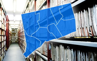
In the Northeastern Connecticut Planning Region, Town Clerks serve as the official custodians of municipal land records. Each Clerk's Office maintains documents that establish, transfer, or affect property ownership, including deeds, mortgages, liens, releases, easements, and certain foreclosure-related records.
Many municipalities preserve records spanning several decades, with older documents often maintained in bound volumes or in archival formats. More recent filings are commonly indexed and stored within electronic land record systems that support public searches.
Since these recorded instruments are maintained locally, access can vary from town to town. Generally, these offices provide public access to land records through in-person research, written requests, or, when available, online portals.
Fees may apply for copies, certifications, and other record services. Record seekers must contact their local Clerk or navigate their official website to obtain the latest fee schedule.
Land records play an important role in property administration. Assessors rely on recorded conveyances to update ownership in the Grand List, while zoning compliance history may be tied to recorded easements or deed restrictions. Title examiners may also depend on the completeness of the grantor-grantee index when evaluating ownership chains.
Municipality-Level Property Records Information
Property records in the Northeastern Connecticut Planning Region are kept at the local level by 16 member towns. Each town takes responsibility for keeping land records, assessment records, tax information, and zoning records on the properties within its jurisdiction.
The municipalities shown below manage these records separately. Their official towns' websites serve as a guide for property searching, requesting records, and obtaining local government services.
County Offices That Maintain Northeastern Connecticut Planning Region Property Records
Due to the nature of the Northeastern Connecticut Planning Region as a county-equivalent region without a conventional county administration, all property records of the region are kept in the offices of each town rather than a central authority.
All 16 towns in the region have their own clerks, assessors, tax collectors, and planning and building departments to keep records of property ownership, assessments, taxation, land use, and development.
Access to property records is generally available by visiting local offices, submitting formal requests to access records, or, in some municipalities, using online record databases.
Other Counties in Connecticut
- Fairfield County
- Greater Bridgeport Planning Region
- Hartford County
- Litchfield County
- Lower Connecticut River Valley Planning Region
- Naugatuck Valley Planning Region
- New Haven County
- New London County
- Northwest Hills Planning Region
- South Central Connecticut Planning Region
- Southeastern Connecticut Planning Region
- Western Connecticut Planning Region